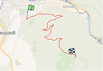
![](/images/other/stat-length.png)
![Trail On foot Gemeinde Waidmannsfeld - Pernitz - Gr. Kitzberg - Waidmannsfeld - Photo](https://media.geolcdn.com/t/1900/400/263c0103-80ab-4608-9392-b08a8b65b97e.jpeg&format=pjpeg&maxdim=2)
Pernitz - Gr. Kitzberg - Waidmannsfeld
SityTrail - itinéraires balisés pédestres
Tous les sentiers balisés d’Europe GUIDE+
![Length](/images/other/stat-length.png)
![Max alt](https://static1.geolcdn.com/siteimages/upload/files/1508320355ic_sort_altitude_max_24dp.png)
![Uphill gradient](https://static1.geolcdn.com/siteimages/upload/files/1508320355ic_sort_den_pos_24dp.png)
![Km-Effort](/images/other/stat-length.png)
![Min alt](https://static1.geolcdn.com/siteimages/upload/files/1508320355ic_sort_altitude_min_24dp.png)
![Downhill gradient](https://static1.geolcdn.com/siteimages/upload/files/1508320355ic_sort_den_neg_24dp.png)
![Boucle](https://static1.geolcdn.com/siteimages/upload/files/16400158638029165_repeat_loop_refresh_sync_direction_icon.png)
![On foot](https://static1.geolcdn.com/sitytour/trail-icons/100.png)
1h31
Difficulty : Easy
![Scan this QR Code to open this trail in the SityTrail application](https://capi.geolives.com/qq0zvz2zws4bq2lad0pu/sitytour/trails/3126235/qr.png?size=200)
FREE GPS app for hiking
About
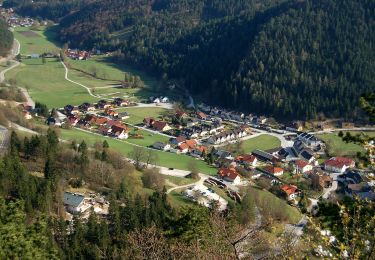
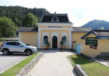
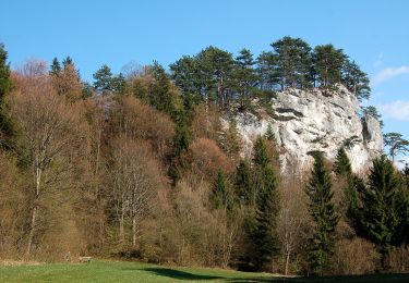
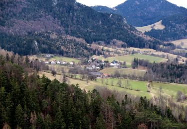
Trail On foot of 3.4 km to be discovered at Lower Austria, Bezirk Wiener Neustadt, Gemeinde Waidmannsfeld. This trail is proposed by SityTrail - itinéraires balisés pédestres.
Description
Trail created by Österreichischer Touristenklub, Sektion Pernitz.
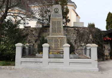
SO-Teil in Relation Reichental-...-Gr.Neukogel
Symbol: grüner waagerechter Balken
Positioning
Comments
Trails nearby
![Trail On foot Gemeinde Waldegg - Dürnbacher Höhenweg - Photo](https://media.geolcdn.com/t/375/260/df9f0f54-c84e-48fa-8dad-e3fcab23898b.jpeg&format=jpg&maxdim=2)
![On foot On foot](https://static1.geolcdn.com/sitytour/trail-icons/100.png)
On foot
![](/images/other/stat-length.png)
![](https://static1.geolcdn.com/siteimages/upload/files/16400158638029165_repeat_loop_refresh_sync_direction_icon.png)
![Trail On foot Gemeinde Muggendorf - Myrafälle - Karnerwirt - Hausstein - Wildgehege - Myrafälle - Photo](https://media.geolcdn.com/t/375/260/82d822f0-5321-43ef-bf7d-e7a9188b8d61.jpeg&format=jpg&maxdim=2)
![On foot On foot](https://static1.geolcdn.com/sitytour/trail-icons/100.png)
On foot
![](/images/other/stat-length.png)
![](https://static1.geolcdn.com/siteimages/upload/files/16400158638029165_repeat_loop_refresh_sync_direction_icon.png)
![Trail On foot Gemeinde Muggendorf - Biedermeier Erlebnisweg (Pernitz - Karnerwirt - Purbach -Eichberggraben) - Photo](https://media.geolcdn.com/t/375/260/82d822f0-5321-43ef-bf7d-e7a9188b8d61.jpeg&format=jpg&maxdim=2)
![On foot On foot](https://static1.geolcdn.com/sitytour/trail-icons/100.png)
On foot
![](/images/other/stat-length.png)
![](https://static1.geolcdn.com/siteimages/upload/files/16400158638029165_repeat_loop_refresh_sync_direction_icon.png)
![Trail On foot Gemeinde Gutenstein - Gutensteiner Panoramaweg - Photo](https://media.geolcdn.com/t/375/260/67c73d6d-3fa9-4f06-a99e-14a517c7cf78.jpeg&format=jpg&maxdim=2)
![On foot On foot](https://static1.geolcdn.com/sitytour/trail-icons/100.png)
On foot
![](/images/other/stat-length.png)
![](https://static1.geolcdn.com/siteimages/upload/files/16400158638029165_repeat_loop_refresh_sync_direction_icon.png)
![Trail On foot Gemeinde Gutenstein - Gutenstein - Purbach (Kasperhof) - Thal - Photo](https://media.geolcdn.com/t/375/260/01662ec0-03ca-4756-8437-42cecb3be8d8.jpeg&format=jpg&maxdim=2)
![On foot On foot](https://static1.geolcdn.com/sitytour/trail-icons/100.png)
On foot
![](/images/other/stat-length.png)
![](https://static1.geolcdn.com/siteimages/upload/files/16400158638029165_repeat_loop_refresh_sync_direction_icon.png)
![Trail On foot Gemeinde Miesenbach - Balbersdorf - Zur Höh - Waldegger Haus - Photo](https://media.geolcdn.com/t/375/260/a8a1c598-9a54-4e52-afa7-51c36f2a506f.jpeg&format=jpg&maxdim=2)
![On foot On foot](https://static1.geolcdn.com/sitytour/trail-icons/100.png)
On foot
![](/images/other/stat-length.png)
![](https://static1.geolcdn.com/siteimages/upload/files/16400158638029165_repeat_loop_refresh_sync_direction_icon.png)
![Trail On foot Gemeinde Waldegg - Dürnbach (Nazwirt) - Klamm - Scheuchenstein - Photo](https://media.geolcdn.com/t/375/260/5a239cca-10cd-4648-91d9-dddff0688598.jpeg&format=jpg&maxdim=2)
![On foot On foot](https://static1.geolcdn.com/sitytour/trail-icons/100.png)
On foot
![](/images/other/stat-length.png)
![](https://static1.geolcdn.com/siteimages/upload/files/16400158638029165_repeat_loop_refresh_sync_direction_icon.png)
![Trail On foot Gemeinde Pernitz - Pernitz Bhf - Neusiedl - Gauermann Hütte - Photo](https://media.geolcdn.com/t/375/260/f0b4b1fe-b8f5-4340-973f-27e475bf62d7.jpeg&format=jpg&maxdim=2)
![On foot On foot](https://static1.geolcdn.com/sitytour/trail-icons/100.png)
On foot
![](/images/other/stat-length.png)
![](https://static1.geolcdn.com/siteimages/upload/files/16400158638029165_repeat_loop_refresh_sync_direction_icon.png)
![Trail On foot Gemeinde Waldegg - Reichental Hst- Gr. Kitzberg - Ochsenheide - Gr. Neukogel - Gutenstein - Photo](https://media.geolcdn.com/t/375/260/67c73d6d-3fa9-4f06-a99e-14a517c7cf78.jpeg&format=jpg&maxdim=2)
![On foot On foot](https://static1.geolcdn.com/sitytour/trail-icons/100.png)
On foot
![](/images/other/stat-length.png)
![](https://static1.geolcdn.com/siteimages/upload/files/16400158638029165_repeat_loop_refresh_sync_direction_icon.png)